
While climbing Mt. Apo and its surrounding
environs, there is only one portion of the mountain that’s very vivid – the ditch
starting from the tail of the Tinikaran Camp 2 jungle and the trail head of the
boulders usually used as rest stop area of mountaineers before a tough boulder
assault. This duct extends to as far as Tolits rock approximately 750 meters
long.
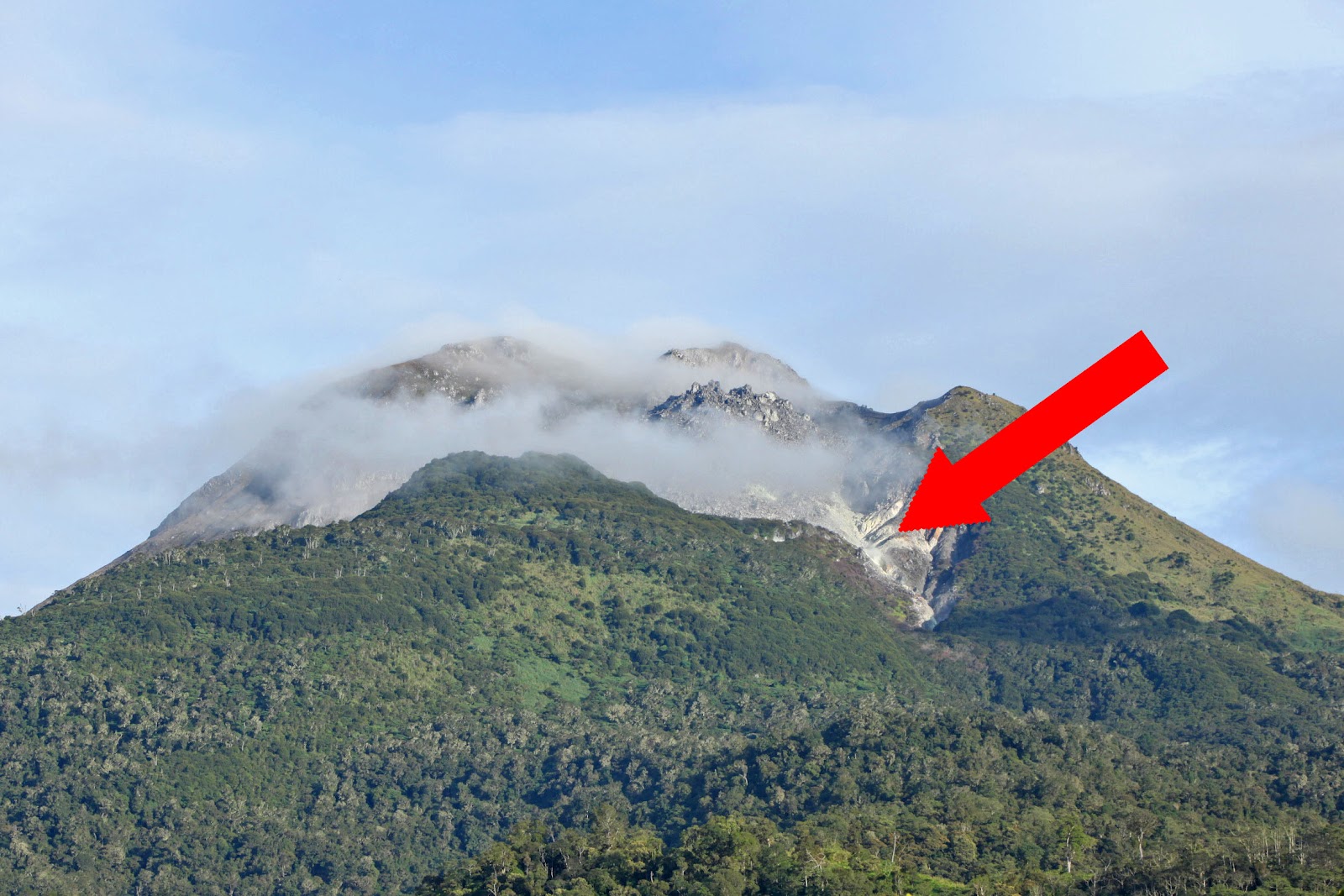 |
| A picture showing the entire Mt. Apo perspective. Red arrow shows LOGSAC Gully |
However, it was never fathomed nor
explored. There were efforts already to breach the said channel either ascending
or descending but all efforts were in vain. Others were frustrated because of
the strong sulfur smoke.
 |
| Climbing buddy Hardy Joy Desuyo enjoying the sulfur scene located at the entrance of the gully. |
It was in year 2004 that we
traversed the upper portion of the gully to the original boulders path. I was
with Papong, Jason Salinas, Manolo del Rosario and Jovany Tajores when we did
that tricky challenge. We have seen the very dangerous features of this gully,
although at one point we were delighted to witness its majestic looks. The
highest vertical point of the gully measures approximately 25 meters long. The couch
was very soft and hot which is attributed to the many sulfur outlets. During
heavy rains, this gully is filled with flowing water directly gushed to the
jungle of Tinikaran.
 |
| LOGSAC gully is shown here subdividing Mt. Apo's Boulder Face. |
It was only during our March 16-18,
2012 climb that I and Jonas christened that channel as LOGSAC Gully, inspired
by the more popular Low’s Gully of Malaysia’s Mt. Kinabalu. It is still located
within Sta. Cruz area of Mt. Apo and has been a dramatic part of the already-trendy
boulder face.
No comments:
Post a Comment