
The Barangay Council of Sinoron and Tribal Community recently invited my group to explore one of its proposed trekking sites located in sitio Sangay. I was informed during the climb that they are few steps away from finally crafting its mountaineering and trekking ordinance which should pave way for the official take off of its ecotourism program in Pilan River, Bagon Spring, Gisi Falls, Kasisi Falls, Dumagok Falls, Sampo Falls and Tacub Laya Falls. If I have this correct vibration I think Sinoron will become the next adventure destination not only in Davao del Sur but the whole region as well.


Finally we have scaled a summit here taller than the famous Mt. Loay in Zone 2. The official elevation is 1,274 MASL and the total trekking distance from Barangay Hall to the Summit Campsite is 9 kilometers. The Bagobo-Tagabawa is the dominant community occupying the entire track made up of farm lands and tropical rainforest. From the difficulty scale employed by Philippine Mountaineering this mountain is within the 5-6/9 category.
Mt. Dinor is the exact opposite of Mt. Loay in terms of overall features. Mt. Dinor is the first of three dominant mountains located in central ranges of Sta. Cruz. The other two are Mt. Tinako and Mt. Baryara. A 45-degree turn southward from Mt. Baryara is Mt. Loay, making these sites a good trekking loop in the municipality. Imagine that, four beautiful summits in one town interconnected to each other is a tremendous mountaineering corridpr in Mindanao. Lovely


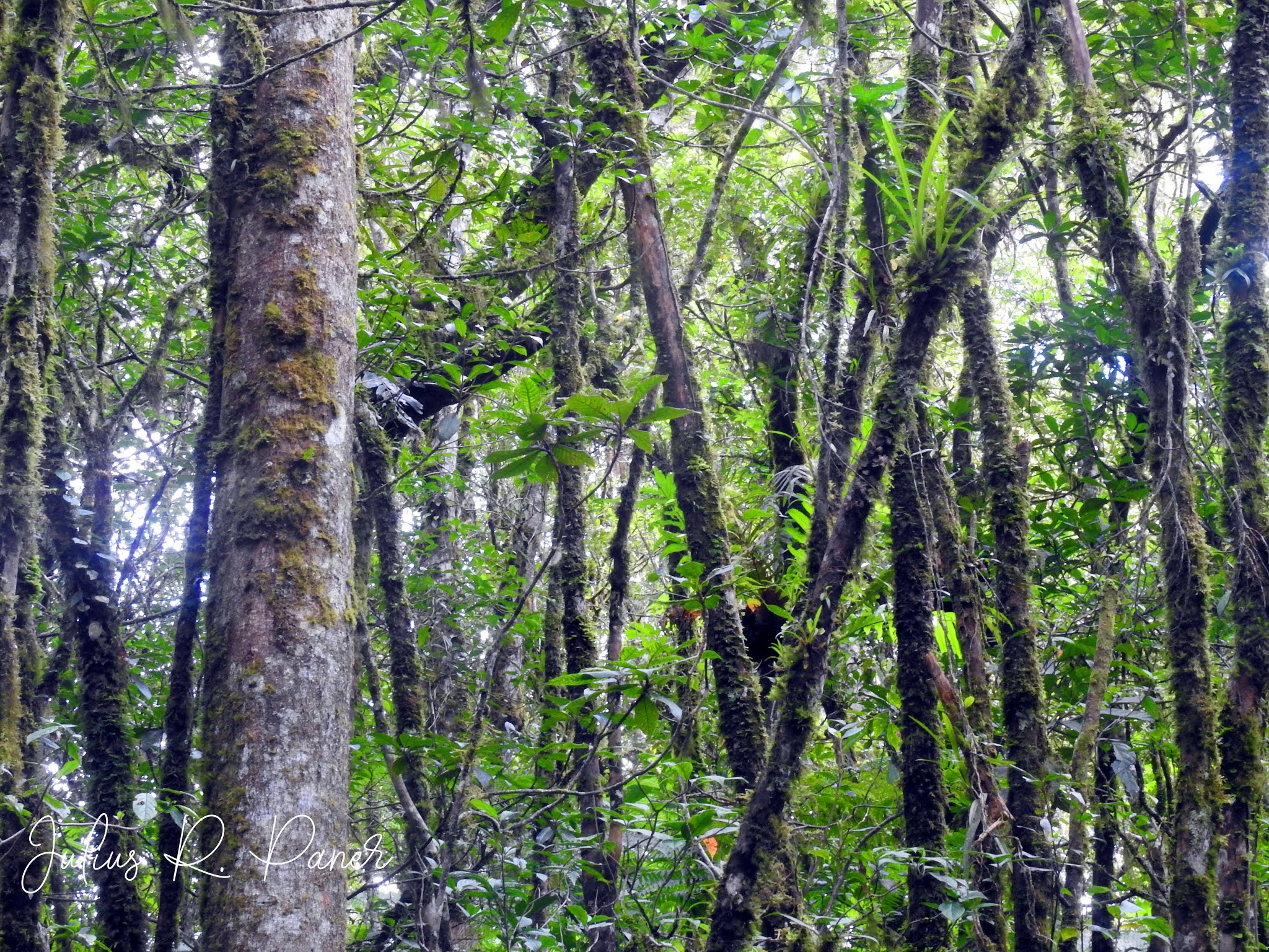
Unlike Loay which is a bald heap, the summit in Mt. Dinor is situated
in an old dipterocarp forest within the Mt. Apo Natural Park. The word “Dinor”
is a Bagobo term for Almaciga, an endemic tree species in the Philippines and
plenty of them can be seen in this mountain. The last 400 meters of the trail
is a bed sheet of beautiful mossy plants and wild flowers. Tracks of Philippine
Deer and Philippine Warty Pig were also seen in the summit. And some birds of
assorted species were observed, including several raptors Philippine Honey
Buzzard, Brahminy Kite and Philippine Serpent Eagle.


The summit campsite measures 1,274 meters above sea level. I recommend
this will be utilized as official campsite for trekkers once Mt. Dinor is ready
to cater mountain climbers in the future. Although there is no water source in
the campsite but the last water source is just 700 meters away, particularly in
the farm house of Nong Dondon Cana. The smaller trees can serve as hammock
anchors for visiting day hikers and trail runners. For overnight campers, a
trek further 200 meters from the campsite could lead to a ridge that connects Mt. Dinor to
Mt. Tinako.


There are important stopovers along the trail of Mt. Dinor that serves as rest areas, all have potable water sources. Most of them are farm houses as temporary shelter and in their own can become attractions already.
Pilan Hanging Bridge (Kilometer 3.5)
Armando Bago Farm House
in Lumaban (Kilometer 4.2)
Jimmy’s Farm House in
Sangay (Kilometer 6.9 (770 masl)
Dondon’s Farm House (Kilometer 7.8 @ 1,005 masl)
Summit Campsite (Kilometer 9 @ 1,274 masl)
Overlooking sceneries in Sta. Cruz can be seen on clear day in these areas. This climb was an affirmation that Sinoron is one of the biggest mountainous barangay in Sta. Cruz. From Dondon’s Farm House where we took a boiled banana break I saw forest edges of Zone 2 in the eastern side and the huge cover in sitio Saroso, Licop, Karamagan and Pilan.


The total trek distance of that traverse day hike is 22 kilometers. We arrived at Pilan Hanging Bridge by 4:00 PM and we instantly took a dip in the river to cool down. Thank you so much to my group LOGSAC for always taking time to join me in expeditions like this.
As a new site for trekking, inquiries can be addressed to the Barangay Council and Tribal Council of Sinoron. The cellphone number of IPMR Datu Wilmar Obedencio is 09121613218.
Hi!
ReplyDeleteThank you for this. May I just ask if it is recommendable for first timers?
Thank you!
Gerlie
Okay lang naman mam Gerlie
ReplyDeleteHi, im a newbie to hiking. And i will be trying mt dinor this weekend.. ive always been afraid.. not of the place or hiking or whatever..but.. rather... Where do you poop? Im almost afraid to ask. Pls reply. Thank you.
ReplyDeletetechnically somewhere na walang masyadong tao :)
Deleteok lng if my madadaanan kang station, pero if wala, you just have to follow the rules of the wild.
I highly recommend Logsac Blogspot for more travel adventures and exciting experience.
ReplyDeleteHello po, do they require local tour guide when hiking the summit in Mt. Dinor? Also, magkano kaya total na magastos like euf, tribal fee, at guide fee.
ReplyDelete