Thursday, November 18, 2021

Chill Hike in Mt. Fortune (519 MASL)

Yes you heard it right, Sta. Cruz is again out to launch another hiking attraction and this time it will be situated in barangay Zone 1, one of the four barangays comprising the Poblacion cluster. It was November 18, 2021 when we were invited by the actual land possessor of the area Mam Aning Guttierez for an ocular visit of Mt. Fortune, a parcel of the Poblacion Mountain Corridor which can be accessed via sitio Malusing. According to her, it was prematurely opened last year but she decided to close it and secured necessary documents before its relaunch with the help of Zone 1 Barangay Tribal Chieftain Bae Dionila Bautista who was with us also during the visit.Mt. Fortune is still within the Unified Bagobo-Tagabawa Ancestral Domain, which is why a Certificate of Precondition is required through the office of the National Commission for Indigenous Peoples (NCIP).

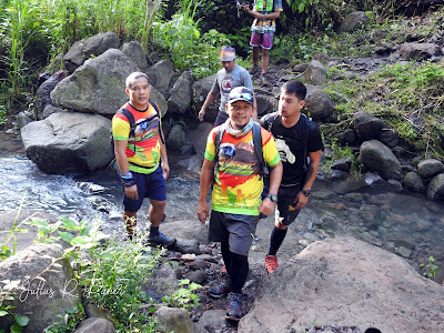
A short 2.7 kilometers single track is a highlight that made us all worn out because we started the trek by 9:30 in the morning when the sun was already heating up like a pressure cooker. It took us 1 hour to arrive in the summit, and just before we were able to settle down we were warmly greeted by Mam Aning and Bae Dionila.

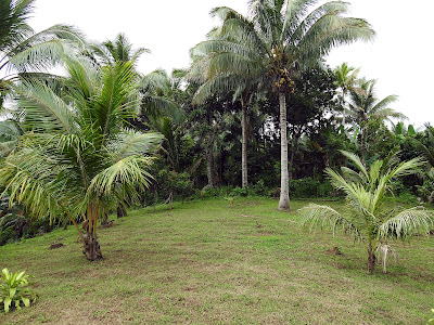
What made Mt. Fortune distinct from the other hiking sites in Sta. Cruz is that this is more of a resort type, with some structures provided by the owner to give comfort to its visitors. Simple open cottages are available, as well as clean toilet, a kitchen, water source, colorful pathways and even a traditional basketball court. There are also two designated camping sites and a hammock site under the shade of Ipil-ipil trees. Mam Aning is excited for the impending launching schedule of Mt. Fortune which I think can be done by December, because she is out to also offer food items as short orders for visiting guests.

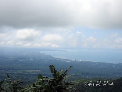
The highest point measures 519 MASL, but since the jump off point is in a ground zero location the trek still offers some kind of adrenalin. The trail is almost the same with that of Mt. Loay, but Mt. Fortune has plenty of water sources along the way. The summit of Seven-Nine-Six is a good shade here of the afternoon sun, and a view deck in the northern part offers clear view of Mt. Langit-langit, Quibarangan, Langan River, Langan Interior Road going to Busay, Seaoil, My Gas, WL Food Corporation and the Davao Cityscape. Davao Gulf is also very visible from Mt. Fortune’s vantage point.


Official launching of Mt. Fortune was the ultimate schedule we agreed upon with Mam Aning and Bae Dionila and we expect to hold it in December. This minor summit will again form part of the offerings that would solidify our campaign for Sta. Cruz as Mindanao’s Summit Republic. This is ideal for chill hikes and a good attraction for family market with a touch of adrenalin. See you soon in Mt. Fortune. Meanwhile, LOGSAC team would like to thank Mam Aning for the excellent lunch in Mt. Fortune, The site assessment turned out to be a gastronomic avalanche for us. 

Thank you also to our very good friend Jie-R Domingo for facilitating the trek and for the overall coordination. 
Saturday, August 7, 2021

Loay-Baryara-Biyaon Trilogy Day Hike

As of this writing Mt. Loay is still restricted for trekking activity. Barangay and tribal authorities have been finalizing documents and it will take a while for Mt. Loay lovers to be back here. On July 24 however, LOGSAC had to revisit this mountain to explore its extended trail off Mt. Baryara and Mt. Biyaon, a visible neighbors of Mt. Loay that connects another popular hiking attraction in Sinoron, Mt. Dinor.


We took the Orpilina Promised Land jump off point and left our vehicle in one of the residents there. Mt. Loay trail is silent this time, and people here (most of them are mountain guides) were nowhere in the site, perhaps trying to explore another economic alternative in the meantime that the most popular hiking site in Sta. Cruz is close. It is good to be back in Mt. Loay despite the unusual scenery. The community stores are bare, in fact some of them now dilapidated. There was only a handful of business activities unlike before. It saddened me somehow because the premature, unplanned closure of Mt. Loay by the tribal and barangay governments last April resulted to economic mayhem of a fraction of community in Zone 2, Sta. Cruz. Anyway, there are brighter side of things and let us look forward to that.


The summit of Mt. Loay serves as the easiest take off point to Mt. Baryara. An additional 1.5 kilometers of ridge and rainforest trek should be undertaken. But first, we had to go through old bushes in Kanipisan Point to reach a façade of primary dipterocarp woodlands. This portion starts a dense trek, zigzagging rainforest and open ridge that saw beautiful views of Coronon in the right side and Poblacion in the left. The fruiting trees closer to the summit of Mt. Baryara were host to feeding birds such as Black-naped Monarch, Warbling White Eye, Bicolored Flowerpecker, Yellow-bellied Whistler and Little Pied Flycatcher.


The last 700 meters before reaching Mt. Baryara summit is a steep jungle trail. We reached the summit of Mt. Baryara (1,309 MASL) at around 10:00 in the morning. If only there is water source here this could be a really good camping site with shade of tall native trees. We met several local hunters here and we learned that the route connecting Mt. Loay and Mt. Dinor is a highway of Philippine endemic wildlife such as Philippine Warty Pig, Philippine Brown Deer and Long-tailed Macaque. This deserves comprehensive conservation measures by resuming mountain trekking in Loay, otherwise, these people will always resort to wildlife hunting.

Mt. Biyaon is 900 meters away from Mt. Baryara summit, so six of us had to go ahead and took the opportunity to visit another promising peak. When I checked my GPS equipment I learned that Mt. Biyaon is taller than Mt. Baryara at 1,317 MASL, and this small heap will be the tallest among the 5 peaks in between the Zone 2-Sinoron hallway. By the way, Mt. Biyaon belongs to barangay Sinoron already.


With this recent trilogy climb I finally completed the 5 summits in central Sta. Cruz. Of the five, only 2 are presently considered for trekking (Loay and Dinor), that left Mt. Baryara, Mt. Biyaon and Mt. Tinako still off limits to trekkers. But I can always count on some barangay functionaries to help me open up a traverse trail using all these excellent sites. Why not?

Lastly, this series of summits located in this mountain range is a good patch of forest cover that stabilizes the lowland of Poblacion Sta. Cruz. Once this mountain is abused I think there is a resounding trouble coming. The geography of Central Sta. Cruz is made up of crucial layers of coastal, built-up, farm lands and rainforest; the last one having bigger role in keeping its downward counterparts intact.

P.S. Many thanks to my friends in LOGSAC who joined the climb namely: Jorax, Jonas, Kurvy, Vince, Dancel, Anil, Jacko, Froilan, Erwin and John jay.

Friday, June 11, 2021

Hiking Barangay Jose Rizal’s “Bamboo Peak” (1,106 MASL)

Jump Off Point: Sitio Centro, Barangay Jose Rizal
Elevation at Summit: 1,106 MASL 
Trekking Distance: 4.6 Kilometers
Terrain: Moderate to Rolling   
Difficulty Scale: 3/9 

A new hiking site in Sta. Cruz is a work in progress and will be the first official minor mountain attraction in the North District of this town. Locals call it Buntod Ta Laya and is situated within an Ancestral Domain of the Bagobo-Tagabawa. In Bagobo term Buntod means mountain and Laya means Buho, a species of bamboo which is in abundance at the peak. And during our maiden exploration last May 28 we were in unison to call this mountain The Bamboo Peak of Sta. Cruz.


Buntod Ta Laya stands 1,106 MASL and is located at the mountain ranges of sitio Upper Batuno, barangay Jose Rizal. Its peak is a ridge with open plains which could cater for small group camping. The ridge connects to forested areas of Sibulan and Tibolo and forms part of the track off Mt. Libodon. On a clear day a panoramic sites of Coronon, Sibulan and Davao City can be seen. The most dominant scenery though is the huge sugarcane plantation of Astorga, the national highway, the structures of Therma South, Inc. and other companies and the vast Davao Gulf.


The jump off point measures 249 MASL, around 1 kilometer from Barangay Hall of Jose Rizal. The trail measure 4.6 kilometers made up of single tracks and some concrete tire path.  Farmlands of fruit trees, coconut and vegetables made up the vegetation mostly. Some settlements along the trails are also noticed and definitely could become a support-community when tourism takes off here. In a glance Buntod Ta Laya resembles Mt. Loay in terms of topography. This could be another heap for trail running or chill day hikes, a thing that is in during these times of pandemic.

As noticed, the tourism program of Sta. Cruz is geared towards opening new mountain for trekking. First, this town is blessed with a stretch of really good trails, peaks and waterfalls. Second, the Great Outdoors fit well with what is required in the new normal tourism activities. Third, we have good support coming from the locals who fully understood the dynamic of outdoor tourism. And fourth, we have local leaders who have been very supportive to ecotourism program.

Again, I would like to thank my friends in LOGSAC for joining me, together with the Tribal Council of Jose Rizal headed by Matanam Marquez Gunda, in this exploration and documentation climb. Together we have scaled so much sites in this town already and I am more than happy to witness all of them now growing as tourist attractions in their respective barangays. Our continuous search for other sites is still part of decongesting existing areas such as Sinoron, Mt. Loay and Mt. Apo.

As of this writing, Matanam Marquez Gunda and his IPS is already seeking action from the National Commission for Indigenous Peoples to validate the site and to secure Usufruct Agreement in order to formalize ecotourism activity in Buntod Ta Laya.